Why is it called the Via degli Dei?
Find Monte Adone and Monte Venere on a map between Bologna and Florence and the name Via degli Dei begins to explain itself. Bolognese hikers drew up the walking route in the late 1980s. At Monzuno the story gets more interesting: local guides disagree about which god the town owes its name to.

Published on
The gods on the map
Monte Adone and Monte Venere are easy names to recognise. Monzuno is less straightforward. Bologna Welcome prints an explanation that connects the name with Jupiter. Visit Tuscany offers a link with Juno. A walker following the same itinerary could quite reasonably come across both accounts. Neither tourism guide settles the original etymology by itself.
That small disagreement is worth carrying up the hill. The route’s name gathers together divine associations that people recognised in the mountains. A claim that a particular deity actually had a sanctuary on each summit would require quite different evidence.
Who drew the line between the two cities?
Bologna Welcome dates the design of the walk to the late 1980s. The Apennine tourist office identifies the Bolognese hiking group Du pas e na gran magnè and recalls the maps they consulted to find a way south from Piazza Maggiore. Their dialect name roughly means a short walk and a big meal.
On a modern map, the line connecting Bologna with Florence looks almost inevitable. For the people drawing up a walking route, a line meant a series of decisions about which path connected to which. That work gave a single itinerary to a landscape that people had crossed long before it acquired this particular name.
What the paving near Pian di Balestra tells us
On 25 August 1979 Cesare Agostini and Franco Santi uncovered a stretch of paving. They proposed that it belonged to the Flaminia Militare. The local tourist office still describes that identification as a hypothesis. There is a stretch of road surface to examine; giving it the name of a particular military road is a further historical judgement.
Put the dates side by side. The discovery of the stones in 1979 and the making of a hiking route in the late 1980s involved different people asking different questions. Identifying a paved section would still leave a great deal of ground between the two city squares unaccounted for.
The Apennine tourist office on the discovery and its interpretation
A stage to open before Monzuno
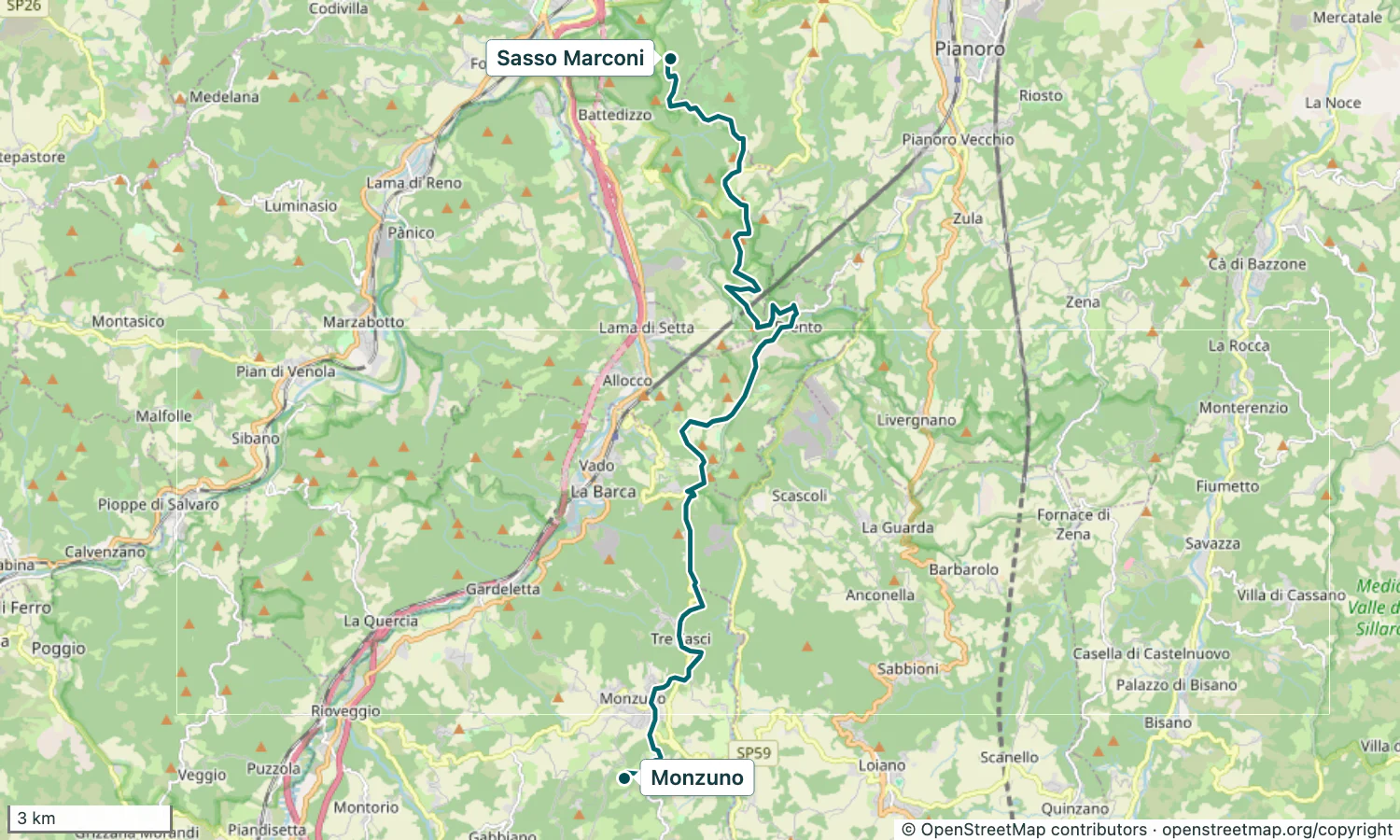
On the stage map above, the line ends at Monzuno. This is the place to look up the two rival readings of its name, Jupiter and Juno. Keep a separate mark for Pian di Balestra, where Agostini and Santi found the paving whose identity is still debated.
Before you go
- Compare the two explanations of Monzuno.
- Distinguish the 1979 find from the modern hiking route.
Walks in this guide
These distances are for the whole walk. Open a route to see which stages you’d like to walk.
- Via Degli dei
- Distance
- 133.6 km
- Stages
- 6 stages