Sasso Marconi → Monzuno
Walking distance 24.1 km
Download Appy for the stage map
Stage information
- Ascent
- 1539 m
- Descent
- 984 m
Difficulty: challenging
Walking the stage
Climb 24 km from Sasso Marconi to Monzuno, passing Raibano and Badolo, with 1539 m of ascent on a demanding day.
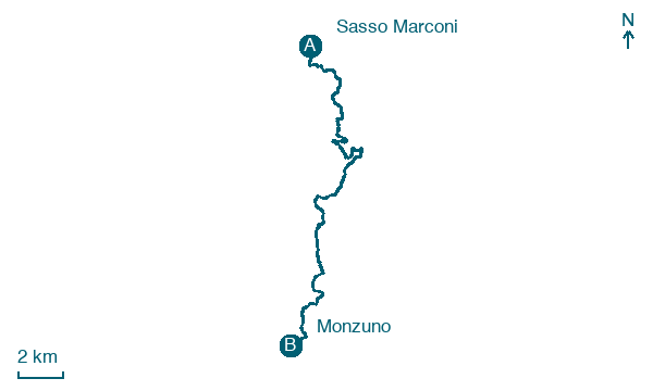
Look for these places on the stage map: Raibano, La Vallazza, Ca' del Cucco, and Tre Fasci.
What to see on this stage
History and landmarks
Lodole
900 m from the trail as the crow flies
Chiesa di S. Michele Arcangelo
Church · 800 m from the trail as the crow flies
Nature and landscape
Monte Adone
Summit · < 100 m from the trail as the crow flies
A sandstone hill of the Bologna Apennines, covered in dry grassland and sparse holm oak, with two Fairy Caves and a few panoramic spots near the top. The high-speed railway runs underneath through a 7,135 metre tunnel that bears the mountain's name.
Contrafforte Pliocenico Nature Reserve
National park · 500 m from the trail as the crow flies
A natural bastion of sandstone cliffs between the Setta, Reno, Savena, Zena and Idice valleys, formed from sands and gravels laid down in the Pliocene, 5 to 2 million years ago, when a sea gulf covered the area.
Map · Sasso Marconi → Monzuno
Take your walk with you: download Appy
Via Degli dei: Sasso Marconi → Monzuno. Explore maps, stages and elevation in the app, and plan your train or bus journey.

