Sala Biellese → Santuario di Graglia
Walking distance 15.7 km
Download Appy for the stage mapStage information
- Ascent
- 623 m
- Descent
- 407 m
Difficulty: moderate (estimated)
Walking the stage
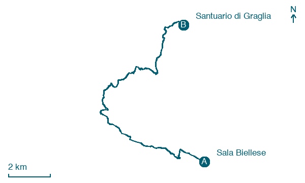
Climb from Sala Biellese to Santuario di Graglia over 16 km, gaining 623 m, through Scalveis, Pianzanetto and Casale.
Look for these places on the stage map: Scalveis, Casale, Chignole, and Regione Bossola.
What to see on this stage
History and landmarks
Castellazzo
Castle · 400 m from the trail as the crow flies
Castle, in Donato, Italy, designated as Italian national heritage.
Santuario, diocesano, Madonna di Loreto
1.4 km from the trail as the crow flies
Climbing from Biella, along one of the last curves before reaching the Sanctuary of Madonna di Loreto, there is the drinking water reservoir of Graglia (1903-1930). Water for Graglia is a primary element of economy and faith.
Map · Sala Biellese → Santuario di Graglia
Take your walk with you: download Appy
Cammino di Oropa della Serra: Sala Biellese → Santuario di Graglia. Explore maps, stages and elevation in the app, and plan your train or bus journey.

