Santuario di Graglia → Santuario di Oropa
Walking distance 14.8 km
Download Appy for the stage mapStage information
- Ascent
- 911 m
- Descent
- 569 m
Difficulty: easy (estimated)
Walking the stage
Walk 15 km from Santuario di Graglia to Santuario di Oropa with a stiff 911 m climb, through Sordevolo, Ostolino and Chiavolino.
Before leaving Santuario di Graglia, locate Chiesa del Santuario di Graglia on the map. It is close to the starting point. On arrival in Santuario di Oropa, consider a stop at Sacro Monte di Oropa, close to the finish.
Look for these places on the stage map: Sordevolo, Ostolino, Favaro di Là, and Valle.
What to see on this stage
History and landmarks
Chiesa del Santuario di Graglia
Church · < 100 m from the trail as the crow flies
Building with a Greek cross plan; vertical structures in continuous masonry of stone and brick plastered; horizontal structures consisting of barrel vaults with lunettes and a dome; roofs with slopes with wooden framework and tile covering.
Sacro Monte di Oropa
200 m from the trail as the crow flies
A path of 19 chapels with frescoes and statues: twelve on the life of the Virgin Mary, seven on episodes of Christian faith, begun in the early 1600s. The chapel of the Crowning of Mary, on the hilltop, holds 156 modelled figures.
Nature and landscape
Riserva speciale del Sacro Monte di Oropa
National park · 300 m from the trail as the crow flies
21st-century national park, in Biella, Italy, covering 1518.0 km².
Riserva naturale del Parco Burcina-Felice Piacenza
National park · 1,000 m from the trail as the crow flies
Wooded hill turned into a park in the 19th century in the style of an English landscape garden, with giant sequoias and a small lake with fountains from 1848. Felice Piacenza worked on it for over fifty years and made its valley of rhododendrons.
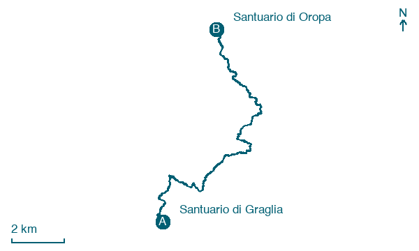
Map · Santuario di Graglia → Santuario di Oropa
Take your walk with you: download Appy
Cammino di Oropa della Serra: Santuario di Graglia → Santuario di Oropa. Explore maps, stages and elevation in the app, and plan your train or bus journey.

