Roppolo → Sala Biellese
Walking distance 17.5 km
Download Appy for the stage mapStage information
- Ascent
- 443 m
- Descent
- 228 m
Difficulty: moderate (estimated)
Walking the stage
Head from Roppolo to Sala Biellese over 18 km, passing Rolle, Zimone and Bose, with 443 m of climbing.
Before leaving Roppolo, locate Castle of Roppolo on the map. It is close to the starting point.
Look for these places on the stage map: Rolle, Bose, Broglina, and Torrazzo.
What to see on this stage
History and landmarks
Castle of Roppolo
Castle · 400 m from the trail as the crow flies
Castle, in Roppolo, Italy, designated as Italian national heritage.
Monte Orsetto
900 m from the trail as the crow flies
A small wooded hill of 452 metres, known above all for prehistoric finds. On its slopes lie the remains of a ring of boulders, probably an Iron Age Celtic outpost, and nearby are rock carvings and the Roc d'la Regina, a stone said to be a queen's sarcophagus.
Nature and landscape
Lake of Bertignano
Lake · 500 m from the trail as the crow flies
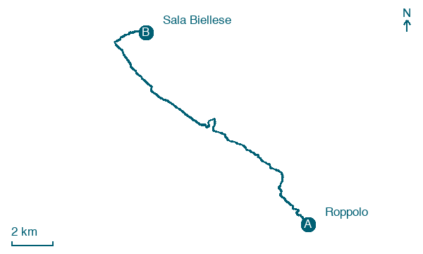
Map · Roppolo → Sala Biellese
Take your walk with you: download Appy
Cammino di Oropa della Serra: Roppolo → Sala Biellese. Explore maps, stages and elevation in the app, and plan your train or bus journey.

