Monte Sacro → Monterotondo
Walking distance 18.1 km
Download Appy for the stage map
Stage information
- Ascent
- 177 m
- Descent
- 93 m
Difficulty: easy
Walking the stage
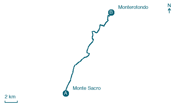
Walk 18 km from Monte Sacro to Monterotondo with 177 m of climbing, passing Settebagni and Borgo Sant' Isidoro.
Before leaving Monte Sacro, locate Platano comune di Viale Jonio Angolo Via Monte Cassino, Roma on the map. It is close to the starting point. On arrival in Monterotondo, consider a stop at Parco, commemorativo /ai caduti di tutte le guerre, Parco della Rimembranza di Monterotondo, close to the finish.
Look for these places on the stage map: Settebagni, Borgo Sant' Isidoro, and Procoio Vecchio.
What to see on this stage
History and landmarks
Parco, commemorativo /ai caduti di tutte le guerre, Parco della Rimembranza di Monterotondo
400 m from the trail as the crow flies
The Park of Remembrance of Monterotondo is located in the external courtyard of Palazzo Orsini, known as the Garden of the Swan, which hosts several commemorative monuments such as that for the fallen of the Navy and the stone dedicated to the fallen of the wars.
Parco della Rimembranza di Mentana
1.9 km from the trail as the crow flies
Commemorative park for the fallen of all wars.
Nature and landscape
Platano comune di Viale Jonio Angolo Via Monte Cassino, Roma
Monumental tree · 400 m from the trail as the crow flies
Italy’s monumental tree register identifies this specimen as Platanus acerifolia (Aiton) Willd. It records a height of 32 m and a trunk circumference of 553 cm.
Mandorlo di Via delle Vigne Nuove 280, Roma
Monumental tree · 600 m from the trail as the crow flies
Italy’s monumental tree register identifies this specimen as Prunus dulcis (Mill.) D.A. Webb. It records a height of 12 m and a trunk circumference of 300 cm.
Map · Monte Sacro → Monterotondo
Take your walk with you: download Appy
Via di Francesco del Sud: Monte Sacro → Monterotondo. Explore maps, stages and elevation in the app, and plan your train or bus journey.

