Roma → Monte Sacro
Walking distance 15.2 km
Download Appy for the stage map
Stage information
- Ascent
- 93 m
- Descent
- 89 m
Difficulty: easy
Walking the stage
Enjoy an easy 15 km walk from Roma to Monte Sacro, with only 93 m of climbing, a full day on foot.
Before leaving Roma, locate Palazzo Rusticucci-Accoramboni on the map. It is close to the starting point.
What to see on this stage
History and landmarks
Palazzo dei Convertendi
Palace · < 100 m from the trail as the crow flies
Palace, designed by Donato Bramante, in Rome, Italy, designated as part of UNESCO World Heritage Site.
Palazzo Rusticucci-Accoramboni
Palace · < 100 m from the trail as the crow flies
Palace, designed by Domenico Fontana, in Rome, Italy.
Nature and landscape
Tiber Urban Oasis
National park · 200 m from the trail as the crow flies
National park, in Roma Capitale, Italy.
Monte Mario Nature Reserve
National park · 600 m from the trail as the crow flies
20th-century national park, in Rome, Italy, covering 206.0 km².
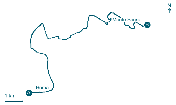
Map · Roma → Monte Sacro
Take your walk with you: download Appy
Via di Francesco del Sud: Roma → Monte Sacro. Explore maps, stages and elevation in the app, and plan your train or bus journey.

