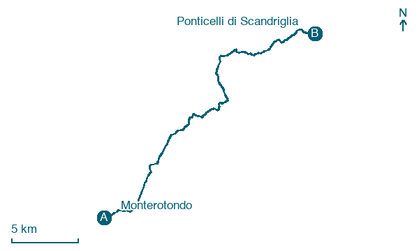
Monterotondo → Ponticelli di Scandriglia
Walking distance 28.9 km
Download Appy for the stage map
Stage information
- Ascent
- 607 m
- Descent
- 296 m
Difficulty: moderate
Walking the stage
Walk 29 km from Monterotondo to Ponticelli di Scandriglia with 607 m of climbing, passing Monterotondo Scalo and Borgo Santa Maria.
Before leaving Monterotondo, locate Parco, commemorativo /ai caduti di tutte le guerre, Parco della Rimembranza di Monterotondo on the map. It is close to the starting point.
Look for these places on the stage map: Monterotondo Scalo, Corese Terra, Montelibretti, and Carlo Corso.
What to see on this stage
History and landmarks
Santuario, diocesano, Santuario Santa Maria delle Grazie
1.4 km from the trail as the crow flies
The place of prayer of Santa Maria delle Grazie is located in the district of Ponticelli within the boundaries of the municipality of Scandriglia, province of Rieti. On September 24, 2024, Mons.
Parco, commemorativo /ai caduti di tutte le guerre, Parco della Rimembranza di Monterotondo
400 m from the trail as the crow flies
The Park of Remembrance of Monterotondo is located in the external courtyard of Palazzo Orsini, known as the Garden of the Swan, which hosts several commemorative monuments such as that for the fallen of the Navy and the stone dedicated to the fallen of the wars.
Nature and landscape
Monte del Lago
Summit · 1.5 km from the trail as the crow flies
Map · Monterotondo → Ponticelli di Scandriglia
Take your walk with you: download Appy
Via di Francesco del Sud: Monterotondo → Ponticelli di Scandriglia. Explore maps, stages and elevation in the app, and plan your train or bus journey.

