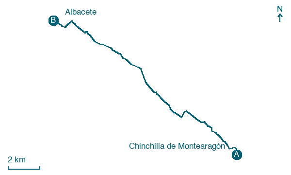
Chinchilla de Montearagón → Albacete
Walking distance 16.1 km
Download Appy for the stage map
Stage information
- Ascent
- 13 m
- Descent
- 184 m
Difficulty: easy
Walking the stage
The walk leaves Chinchilla past the church of Santo Domingo and a cemetery road, then follows a service track close to the highway past the Venta de la Paloma. Entering Albacete means crossing an expressway and the rail lines, including the high speed line, before city streets lead past the Posada del Rosario, a sixteenth century inn mixing Gothic, Mudéjar and Renaissance work. The stage ends at Albacete's Plaza del Altozano, before the Cathedral of San Juan Bautista.
On arrival in Albacete, consider a stop at Museo Municipal de Albacete, close to the finish.
Look for these places on the stage map: La Losilla and La Torrecica.
What to see on this stage
History and landmarks
Museo Municipal de Albacete
Museum · < 100 m from the trail as the crow flies
Municipal Museum of Albacete. 20th-century museum, in Albacete, Spain.
Teatro Circo de Albacete
< 100 m from the trail as the crow flies
19th-century monument, designed by Juan Peyronnet, in Albacete, Spain, designated as bien de interés cultural.
Map · Chinchilla de Montearagón → Albacete
Take your walk with you: download Appy
Camino del Levante: Chinchilla de Montearagón → Albacete. Explore maps, stages and elevation in the app, and plan your train or bus journey.

