Santhià → Roppolo
Walking distance 16.4 km
Download Appy for the stage mapStage information
- Ascent
- 189 m
- Descent
- 101 m
Difficulty: moderate (estimated)
Walking the stage
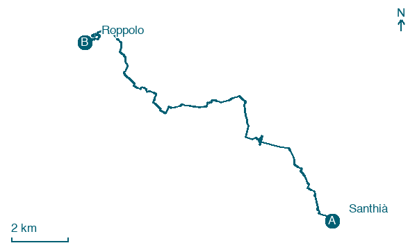
Walk 16 km from Santhià to Roppolo, passing La Mandria, Maiole and Cavaglià, with 189 m of climbing.
Before leaving Santhià, locate Remains of crenellated wall around the garden of the rectory on the map. It is close to the starting point. On arrival in Roppolo, consider a stop at Castle of Roppolo, close to the finish.
Look for these places on the stage map: La Mandria, Maiole, Cavaglià, and Salomone.
What to see on this stage
History and landmarks
Castle of Roppolo
Castle · < 100 m from the trail as the crow flies
Castle, in Roppolo, Italy, designated as Italian national heritage.
Remains of crenellated wall around the garden of the rectory
< 100 m from the trail as the crow flies
Remains of the city fortifications of the village of Santhià, linear perimeter, angular portion; vertical structures in continuous masonry made of cobblestones in herringbone pattern and brick, with signs of consolidations already present in 1979 (chain heads); brick decorations in dentate style.
Nature and landscape
Bagolaro di Via Giovanni Beduglio 2, Dorzano
Monumental tree · 1.2 km from the trail as the crow flies
Italy’s monumental tree register identifies this specimen as Celtis australis L. It records a height of 18 m and a trunk circumference of 402 cm.
Lake of Bertignano
Lake · 1.4 km from the trail as the crow flies
Map · Santhià → Roppolo
Take your walk with you: download Appy
Cammino di Oropa della Serra: Santhià → Roppolo. Explore maps, stages and elevation in the app, and plan your train or bus journey.

