Ponticelli di Scandriglia → Rieti
Walking distance 42.4 km
Download Appy for the stage map
Stage information
- Ascent
- 796 m
- Descent
- 710 m
Difficulty: challenging
Walking the stage
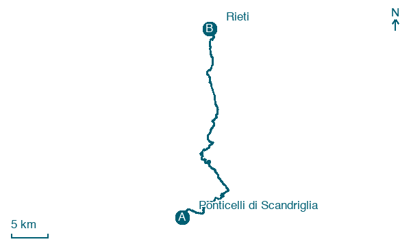
Climb 796 m over 42 km from Ponticelli di Scandriglia to Rieti, passing Scandriglia and Ponticelli Sabino.
On arrival in Rieti, consider a stop at Fontana dei Delfini, close to the finish.
Look for these places on the stage map: Scandriglia, Cerdomare, Ornaro Basso, and Fonte Colombo.
What to see on this stage
History and landmarks
Fontana dei Delfini
< 100 m from the trail as the crow flies
Fountain of the Dolphins. Fountain, in Rieti, Italy, designated as Italian national heritage.
Ponte romano di Rieti
Bridge · < 100 m from the trail as the crow flies
The Roman Bridge is a bridge from the Roman era that spanned the Velino River in Rieti.
Map · Ponticelli di Scandriglia → Rieti
Take your walk with you: download Appy
Via di Francesco del Sud: Ponticelli di Scandriglia → Rieti. Explore maps, stages and elevation in the app, and plan your train or bus journey.

