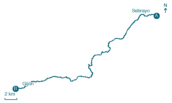
Sebrayo → Gijón
Walking distance 34.8 km
Download Appy for the stage map
Stage information
- Ascent
- 520 m
- Descent
- 301 m
Difficulty: challenging (estimated)
Walking the stage
Walk 35 km from Sebrayo to Gijón, via Villaviciosa and El Pulu Baxu, with 520 m of ascent.
Before leaving Sebrayo, locate Sebrayu on the map. It is close to the starting point.
Look for these places on the stage map: Pandu, La Corolla, Moral, and La Cuesta.
What to see on this stage
History and landmarks
Sebrayu
< 100 m from the trail as the crow flies
Historic village, in Miravalles, Spain, at 16 m elevation.
Iglesia de Santiago el Mayor (Sariego)
Church · < 100 m from the trail as the crow flies
Church in pre-Romanesque art style, dedicated to St. James the Elder, in Sariegu, Spain, designated as bien de interés cultural.
Nature and landscape
El Peñón
Summit · 300 m from the trail as the crow flies
Monte de la Berruga
Summit · 500 m from the trail as the crow flies
Map · Sebrayo → Gijón
Take your walk with you: download Appy
Camino del Norte: Sebrayo → Gijón. Explore maps, stages and elevation in the app, and plan your train or bus journey.

