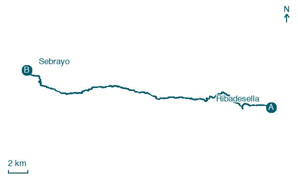
Ribadesella → Sebrayo
Walking distance 30.6 km
Download Appy for the stage map
Stage information
- Ascent
- 480 m
- Descent
- 485 m
Difficulty: challenging (estimated)
Walking the stage
Head from Ribadesella to Sebrayo over 31 km and 480 m of ascent, through Abéu, Berbes and Cerracín.
Before leaving Ribadesella, locate Cave of Tito Bustillo on the map. It is close to the starting point. On arrival in Sebrayo, consider a stop at Sebrayu, close to the finish.
Look for these places on the stage map: San Pedru, La Cantiella, Pis, and Les Tarandielles.
What to see on this stage
History and landmarks
Sebrayu
< 100 m from the trail as the crow flies
Historic village, in Miravalles, Spain, at 16 m elevation.
Cave of Tito Bustillo
800 m from the trail as the crow flies
Monument, in Ribadesella, Spain, designated as bien de interés cultural, covering 243.4 km².
Nature and landscape
Beach of Santa Marina, Ribeseya
Beach · 400 m from the trail as the crow flies
Pico de la Cerrá
Summit · 600 m from the trail as the crow flies
Map · Ribadesella → Sebrayo
Take your walk with you: download Appy
Camino del Norte: Ribadesella → Sebrayo. Explore maps, stages and elevation in the app, and plan your train or bus journey.

