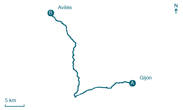
Gijón → Avilés
Walking distance 45.6 km
Download Appy for the stage map
Stage information
- Ascent
- 366 m
- Descent
- 563 m
Difficulty: challenging (estimated)
Walking the stage
Cover the longest day of 46 km from Gijón to Avilés, via Noreña and Les Peñes, with 366 m of ascent.
Look for these places on the stage map: Forfontía, Oviedo / Uviéu, Veyo, and Piqueros.
What to see on this stage
History and landmarks
Foncalada
< 100 m from the trail as the crow flies
Monument in pre-Romanesque art style, in Oviedo, Spain, designated as part of UNESCO World Heritage Site.
Casa de los Campomanes
< 100 m from the trail as the crow flies
Monument, in Oviedo City, Spain, designated as bien de interés cultural.
Nature and landscape
Embalse de Trasona
Lake · 1 km from the trail as the crow flies
Lake. The Trasona Reservoir (Spanish: Embalse de Trasona) is a reservoir in Asturias, Spain across the Alvares River.
El Picu Sierra
Summit · 200 m from the trail as the crow flies
Map · Gijón → Avilés
Take your walk with you: download Appy
Camino del Norte: Gijón → Avilés. Explore maps, stages and elevation in the app, and plan your train or bus journey.

