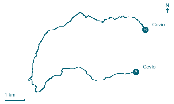
Cevio → Cevio
Walking distance 16.7 km
Download Appy for the stage map
Stage information
- Ascent
- 1117 m
- Descent
- 901 m
Difficulty: challenging
Walking the stage
Do a 17 km loop from Cevio through Riale / Chärbäch, climbing 1,117 m before you return to the start.
Look for these places on the stage map: Riale / Chärbäch.
What to see on this stage
History and landmarks
Sperrstelle San Giacomo
1.2 km from the trail as the crow flies
Nature and landscape
All'Uomo
Summit · < 100 m from the trail as the crow flies
Peak, in Canton of Ticino, Switzerland, at 2,241 m elevation.
Pizzo Grandinagia
Summit · 200 m from the trail as the crow flies
Peak, in Vallemaggia District, Switzerland, at 2,774 m elevation.
Map · Cevio → Cevio
Take your walk with you: download Appy
Trekking dei Laghetti: Cevio → Cevio. Explore maps, stages and elevation in the app, and plan your train or bus journey.

