Lavizzara → Cevio
Walking distance 11.2 km
Download Appy for the stage map
Stage information
- Ascent
- 1154 m
- Descent
- 1020 m
Difficulty: challenging
Walking the stage
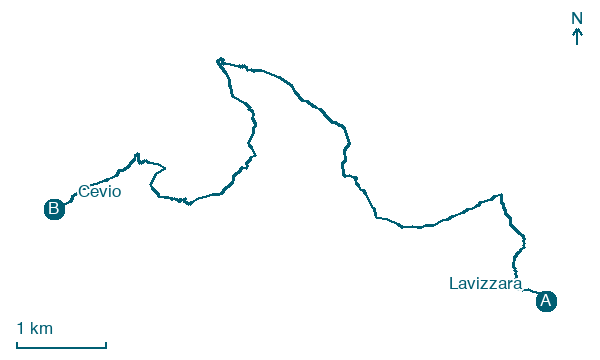
Walk 11 km from Lavizzara to Cevio, with 1,154 m of climbing packed into one single day of trail.
What to see on this stage
Nature and landscape
Lago Nero
Lake · 200 m from the trail as the crow flies
Lake, dedicated to black, in Canton of Ticino, Switzerland, at 1,904 m elevation.
Poncione di Braga
Summit · 300 m from the trail as the crow flies
A summit of 2,864 metres in the Lepontine Alps, in the Basodino-Cristallina-Biela chain between Pizzo Cristallina and Pizzo Castello. The climb to the top starts from the Capanna Poncione di Braga hut, at 2,003 metres.
Map · Lavizzara → Cevio
Take your walk with you: download Appy
Trekking dei Laghetti: Lavizzara → Cevio. Explore maps, stages and elevation in the app, and plan your train or bus journey.

