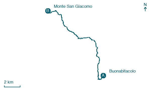
Buonabitacolo → Monte San Giacomo
Walking distance 16.3 km
Download Appy for the stage map
Stage information
- Ascent
- 632 m
- Descent
- 458 m
Difficulty: moderate
Walking the stage
Walk 16 km from Buonabitacolo to Monte San Giacomo with 632 m of climbing, passing Ponte Peglio and Sassano.
Before leaving Buonabitacolo, locate Bonohabitaculo on the map. It is close to the starting point.
Look for these places on the stage map: Ponte Peglio and Sassano.
What to see on this stage
History and landmarks
Sassano
< 100 m from the trail as the crow flies
The historic center has ancient origins integrated with buildings that arose after the war.
Bonohabitaculo
700 m from the trail as the crow flies
The center still preserves the ancient urban layout: the characteristic pattern of the settlement, with regular lots distributed along the longitudinal development of the main road, constitutes a unique feature in the Vallo landscape and confirms its character as a new foundation.
Map · Buonabitacolo → Monte San Giacomo
Take your walk with you: download Appy
Cammino del Negro: Buonabitacolo → Monte San Giacomo. Explore maps, stages and elevation in the app, and plan your train or bus journey.

