Monte San Giacomo → Teggiano
Walking distance 6.3 km
Download Appy for the stage map
Stage information
- Ascent
- 406 m
- Descent
- 484 m
Difficulty: moderate
Walking the stage
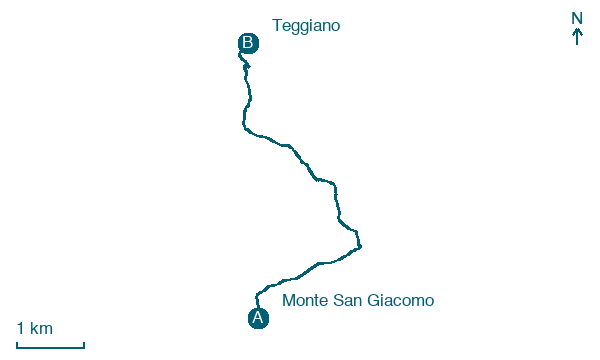
Walk 6 km from Monte San Giacomo to Teggiano with 406 m of climbing, passing Sassano, a short stage.
On arrival in Teggiano, consider a stop at Guglia di San Cono, close to the finish.
Look for these places on the stage map: Sassano.
What to see on this stage
History and landmarks
Guglia di San Cono
< 100 m from the trail as the crow flies
A tall obelisk with a statue of San Cono on top, about 20 metres up. The town raised it to thank the saint, who by local tradition protected Teggiano in the earthquake of 17 December 1857.
Castello Macchiaroli
Castle · < 100 m from the trail as the crow flies
A medieval castle tied to the Sanseverino family, who made it a fortress hard to take during the Barons' Conspiracy of 1485. It passed to the Macchiaroli family in the nineteenth century and still hosts visits and events.
Map · Monte San Giacomo → Teggiano
Take your walk with you: download Appy
Cammino del Negro: Monte San Giacomo → Teggiano. Explore maps, stages and elevation in the app, and plan your train or bus journey.

