Sanza → Buonabitacolo
Walking distance 9 km
Download Appy for the stage map
Stage information
- Ascent
- 244 m
- Descent
- 280 m
Difficulty: easy
Walking the stage
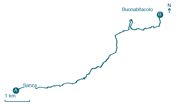
Walk 9 km from Sanza to Buonabitacolo with 244 m of climbing, a short stage that ends in Buonabitacolo.
Before leaving Sanza, locate Sontia on the map. It is close to the starting point.
What to see on this stage
History and landmarks
Sontia
< 100 m from the trail as the crow flies
The urban layout of the historic nucleus is typical of the late Middle Ages and features a wrapping development scheme; it is situated on top of a hill with predominantly curvilinear streets.
Santuario, mariano, diocesano, Cappella Madonna del Cervato
Church · 200 m from the trail as the crow flies
At the beginning of the 13th century, the Archconfraternity of Santa Maria della Neve was established. The ancient chapel built not far from a cave where the Virgin was venerated under the same title was enlarged in 1599.
Map · Sanza → Buonabitacolo
Take your walk with you: download Appy
Cammino del Negro: Sanza → Buonabitacolo. Explore maps, stages and elevation in the app, and plan your train or bus journey.

