Bach → Radenthein
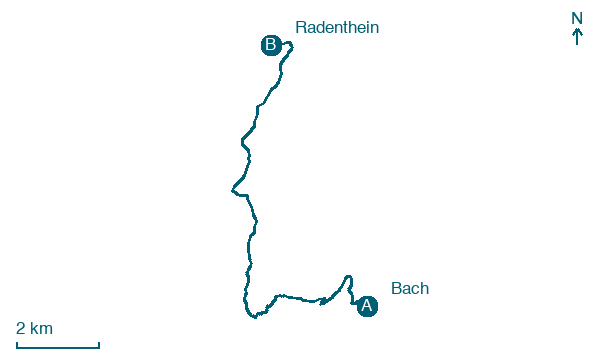
Walking distance 13.1 km
Download Appy for the stage map
Stage information
- Ascent
- 1207 m
- Descent
- 564 m
Difficulty: challenging
Walking the stage
Climb 1,207 m in just 13 km from Bach to Radenthein, passing Obertschern, Untertschern and Sankt Oswald.
Before leaving Bach, locate Filialkirche St. Katharina im Bade on the map. It is close to the starting point.
Look for these places on the stage map: Obertschern, Untertschern, Staudach, and Sankt Oswald.
What to see on this stage
History and landmarks
Spitzeck
200 m from the trail as the crow flies
Natural landmark, in Bad Kleinkirchheim, Austria, at 1,909 m elevation.
Filialkirche St. Katharina im Bade
300 m from the trail as the crow flies
Heritage site in Gothic style, dedicated to Catherine of Alexandria, in Bad Kleinkirchheim, Austria, designated as Listed objects in Austria.
Nature and landscape
Priedröf
Summit · < 100 m from the trail as the crow flies
Peak, in Radenthein, Austria, at 1,963 m elevation.
Wiesernock
Summit · < 100 m from the trail as the crow flies
Peak, in Radenthein, Austria, at 1,974 m elevation.
Map · Bach → Radenthein
Take your walk with you: download Appy
Nockberge-Trail: Bach → Radenthein. Explore maps, stages and elevation in the app, and plan your train or bus journey.

