Reichenau → Bach
Walking distance 12.9 km
Download Appy for the stage map
Stage information
- Ascent
- 403 m
- Descent
- 1259 m
Difficulty: moderate
Walking the stage
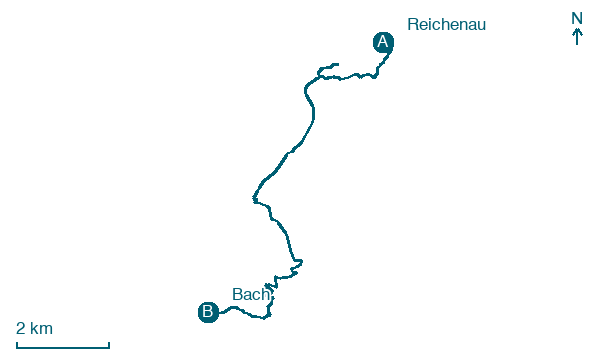
Follow 13 km from Reichenau to Bach through Bad Kleinkirchheim, an easier day with 403 m of climbing.
Before leaving Reichenau, locate Falkertsee on the map. It is close to the starting point.
Look for these places on the stage map: Bad Kleinkirchheim.
What to see on this stage
History and landmarks
Pfarrkirche Bad Kleinkirchheim
< 100 m from the trail as the crow flies
Heritage site in baroque style, in Bad Kleinkirchheim, Austria, designated as Listed objects in Austria.
Jakobskapelle
< 100 m from the trail as the crow flies
Heritage site, in Bad Kleinkirchheim, Austria, designated as Listed objects in Austria.
Nature and landscape
Falkert
Summit · < 100 m from the trail as the crow flies
Peak, in Bad Kleinkirchheim, Austria, at 2,308 m elevation.
Falkertsee
Lake · < 100 m from the trail as the crow flies
A small high mountain lake at 1,872 metres, probably glacial in origin, about 300 metres long and up to 13 metres deep. For an alpine lake the surface water runs warm, reaching 13 °C in summer.
Map · Reichenau → Bach
Take your walk with you: download Appy
Nockberge-Trail: Reichenau → Bach. Explore maps, stages and elevation in the app, and plan your train or bus journey.

