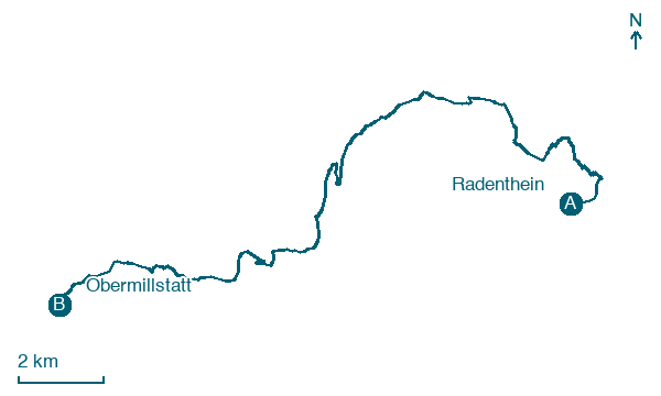
Radenthein → Obermillstatt
Walking distance 21.7 km
Download Appy for the stage map
Stage information
- Ascent
- 1047 m
- Descent
- 825 m
Difficulty: challenging
Walking the stage
Head 22 km from Radenthein to Obermillstatt, a long stage with 1,047 m of ascent and no towns in between.
What to see on this stage
History and landmarks
Pfannnock
700 m from the trail as the crow flies
A 2,254 metre summit of the Nockberge, in the core zone of the biosphere park. Iron ore was mined on its west side until 1885 and the old spoil heaps still stand out by colour; a tiny lake, the Pfannsee, sits in a hollow to the east.
Tschierweger Nock
1.3 km from the trail as the crow flies
Natural landmark, in Millstatt am See, Austria, at 2,010 m elevation.
Nature and landscape
Map · Radenthein → Obermillstatt
Take your walk with you: download Appy
Nockberge-Trail: Radenthein → Obermillstatt. Explore maps, stages and elevation in the app, and plan your train or bus journey.

