Simancas → Peñaflor de Hornija
Walking distance 21 km
Download Appy for the stage map
Stage information
- Ascent
- 179 m
- Descent
- 75 m
Difficulty: moderate
Walking the stage
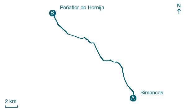
Leaving Simancas castle behind, the path goes under the A-62 highway and climbs to moorland tracks past Ciguñuela. In Wamba the Visigothic and Mozarabic Iglesia de Santa María, dating from the tenth century, keeps an ancient monastic ossuary, and past windmill fields the walk climbs Discordia street into Peñaflor de Hornija.
Before leaving Simancas, locate General Archive of Simancas on the map. It is close to the starting point.
Look for these places on the stage map: Ciguñuela and Wamba.
What to see on this stage
History and landmarks
General Archive of Simancas
< 100 m from the trail as the crow flies
16th-century monument, in Simancas, Spain, designated as Memory of the World International Register.
Castle of Simancas
Castle · < 100 m from the trail as the crow flies
Castle. Designated as bien de interés cultural.
Map · Simancas → Peñaflor de Hornija
Take your walk with you: download Appy
Camino de Madrid: Simancas → Peñaflor de Hornija. Explore maps, stages and elevation in the app, and plan your train or bus journey.

