Avilés → Muros de Nalón
Walking distance 21.6 km
Download Appy for the stage map
Stage information
- Ascent
- 393 m
- Descent
- 287 m
Difficulty: moderate (estimated)
Walking the stage
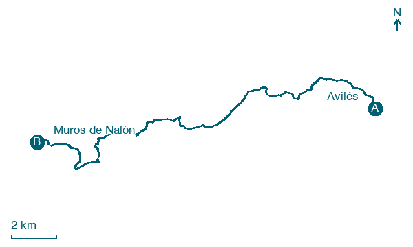
Continue 22 km from Avilés to Muros de Nalón through Piedrasblancas and El Muru, with 393 m of ascent.
Before leaving Avilés, locate Artistic Historical Complex of Avilés on the map. It is close to the starting point.
Look for these places on the stage map: Solaiglesia, El Muru, El Forcón, and La Madalena.
What to see on this stage
History and landmarks
Capilla de los Alas
< 100 m from the trail as the crow flies
Monument in Gothic style, in Avilés, Spain, designated as part of UNESCO World Heritage Site.
Artistic Historical Complex of Avilés
< 100 m from the trail as the crow flies
Monument, in Avilés, Spain, designated as part of UNESCO World Heritage Site.
Nature and landscape
Real Club Náutico de Salinas
1.5 km from the trail as the crow flies
Salinas Beach
Beach · 1.4 km from the trail as the crow flies
Map · Avilés → Muros de Nalón
Take your walk with you: download Appy
Camino del Norte: Avilés → Muros de Nalón. Explore maps, stages and elevation in the app, and plan your train or bus journey.

