Lavizzara → Fusio
Walking distance 12.7 km
Download Appy for the stage map
Stage information
- Ascent
- 738 m
- Descent
- 1696 m
Difficulty: moderate
Walking the stage
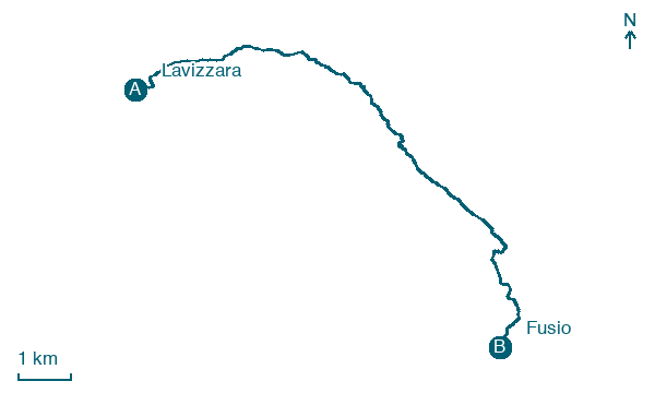
Close the trek by walking 13 km from Lavizzara to Fusio, with 738 m of climbing left to do.
What to see on this stage
History and landmarks
Il Madone
1.3 km from the trail as the crow flies
Il Madone is a mountain of the Lepontine Alps, located in the Swiss canton of Ticino. On its southern side lies Lago del Narèt.
Pizzo Sella
1.8 km from the trail as the crow flies
Natural landmark, in Canton of Ticino, Switzerland, at 2,516 m elevation.
Nature and landscape
Pizzo di Corno
Summit · 300 m from the trail as the crow flies
Peak, in Vallemaggia District, Switzerland, at 2,501 m elevation.
Lago del Sambuco
Lake · 500 m from the trail as the crow flies
A reservoir of 1.11 square kilometres made by the Sambuco dam on the Maggia, 130 metres high, completed in 1956. It belongs to the Naret lakes, of glacial origin, where the Maggia begins.
Map · Lavizzara → Fusio
Take your walk with you: download Appy
Trekking dei Laghetti: Lavizzara → Fusio. Explore maps, stages and elevation in the app, and plan your train or bus journey.

