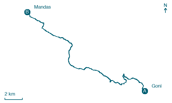
Goni → Mandas
Walking distance 22.4 km
Download Appy for the stage map
Stage information
- Ascent
- 502 m
- Descent
- 406 m
Difficulty: moderate
Walking the stage
The path passes under the Nuraghe di Goni and on to Siurgus Donigala, where the Gothic-Catalan church of San Teodoro stands near Lago Mulargia. After about 23 km on concrete lanes and dirt roads, the stage reaches Mandas and the bell tower of its Chiesa di San Giacomo, beside the former convent.
Before leaving Goni, locate Domus Suas Complex on the map. It is close to the starting point. On arrival in Mandas, consider a stop at Pino d'Aleppo di Stazione Ferroviaria, Mandas, close to the finish.
Look for these places on the stage map: Seurgus Donigala/Siurgus Donigala.
What to see on this stage
History and landmarks
Nuraghe Goni
Archaeological site · 100 m from the trail as the crow flies
A circular single-tower building constructed on a plateau, which incorporates natural rock outcrops into its base structures.
Domus Suas Complex
Archaeological site · 400 m from the trail as the crow flies
The complex consists of a circular structure of Nuragic tradition, two adjacent funerary structures, and a giant's tomb.
Nature and landscape
Olivastro di Mesoni Margiani, Siurgus Donigala
Monumental tree · < 100 m from the trail as the crow flies
Italy’s monumental tree register identifies this specimen as Olea europaea subsp. oleaster (Hoffmanns. & Link). It records a height of 10 m and a trunk circumference of 560 cm.
Pino d'Aleppo di Stazione Ferroviaria, Mandas
Monumental tree · 300 m from the trail as the crow flies
Italy’s monumental tree register identifies this specimen as Pinus halepensis Mill. It records a height of 20 m and a trunk circumference of 330 cm.
Map · Goni → Mandas
Take your walk with you: download Appy
Cammino di Santu Jacu: Goni → Mandas. Explore maps, stages and elevation in the app, and plan your train or bus journey.

