Santiago de Compostela → Negreira
Walking distance 20.7 km
Download Appy for the stage map
Stage information
- Ascent
- 429 m
- Descent
- 505 m
Difficulty: moderate
Walking the stage
Leave Santiago de Compostela for Negreira, 21 km with 429 m of ascent, through Sarela de Abaixo and Pedrido.
Before leaving Santiago de Compostela, locate Palacio de Rajoy on the map. It is close to the starting point.
Look for these places on the stage map: Sarela de Abaixo, Portela, Carballo, and Os Outeiros.
What to see on this stage
History and landmarks
Palacio de Rajoy
Palace · < 100 m from the trail as the crow flies
18th-century neoclassical architecture palace. Designed by Carlos Lemaur.
Colección dos Gabinetes de Ciencias do Antigo Instituto de Santiago
Museum · < 100 m from the trail as the crow flies
Museum, in Santiago de Compostela, Spain.
Nature and landscape
O Pedrouzo
Summit · < 100 m from the trail as the crow flies
O Cotón Negro
Summit · 200 m from the trail as the crow flies
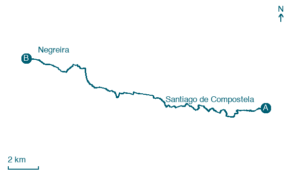
Map · Santiago de Compostela → Negreira
Take your walk with you: download Appy
Camino a Fisterra-Muxía: Santiago de Compostela → Negreira. Explore maps, stages and elevation in the app, and plan your train or bus journey.

