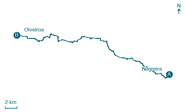
Negreira → Olveiroa
Walking distance 33.6 km
Download Appy for the stage map
Stage information
- Ascent
- 448 m
- Descent
- 348 m
Difficulty: moderate
Walking the stage
Cover the long 34 km from Negreira to Olveiroa, via San Martiño and Vilaserío, with 448 m of ascent.
Before leaving Negreira, locate Pazo do Cotón on the map. It is close to the starting point.
Look for these places on the stage map: O Camiño Real, Vilaserío, Bo Xesús, and A Ponte Olveira.
What to see on this stage
History and landmarks
Mámoa de Pena Silveira
Archaeological site · < 100 m from the trail as the crow flies
Pazo do Cotón
< 100 m from the trail as the crow flies
Nature and landscape
Porto Cabalar
Summit · < 100 m from the trail as the crow flies
A Sanguiñeira
Summit · < 100 m from the trail as the crow flies
Map · Negreira → Olveiroa
Take your walk with you: download Appy
Camino a Fisterra-Muxía: Negreira → Olveiroa. Explore maps, stages and elevation in the app, and plan your train or bus journey.

