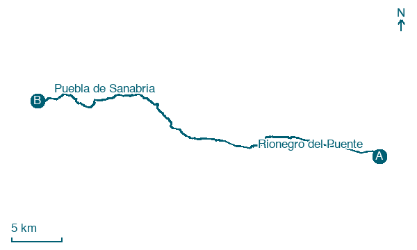
Rionegro del Puente → Puebla de Sanabria
Walking distance 40.5 km
Download Appy for the stage map
Stage information
- Ascent
- 1180 m
- Descent
- 1076 m
Difficulty: challenging (estimated)
Walking the stage
Go the full 40 km from Rionegro del Puente to Puebla de Sanabria via Mombuey, climbing 1,180 m on the way.
Look for these places on the stage map: Santa Eulalia del Río Negro, Cernadilla, Palacios de Sanabria, and Triufé.
What to see on this stage
History and landmarks
Entrepeñas
1.3 km from the trail as the crow flies
Historic village. Entrepeñas is a locality located within the municipality of Asturianos, province of Zamora, Castile and León, Spain.
Lagarejos de la Carballeda
1.3 km from the trail as the crow flies
Historic village, in Asturianos, Spain, at 974 m elevation.
Nature and landscape
Cernadilla Reservoir
Lake · 700 m from the trail as the crow flies
Lake, in Zamora Province, Spain, at 889 m elevation.
Alto de Cogollada
Summit · 1.7 km from the trail as the crow flies
Map · Rionegro del Puente → Puebla de Sanabria
Take your walk with you: download Appy
Camino Sanabres: Rionegro del Puente → Puebla de Sanabria. Explore maps, stages and elevation in the app, and plan your train or bus journey.

