Rofrano → Abatemarco
Walking distance 11.9 km
Download Appy for the stage map
Stage information
- Ascent
- 867 m
- Descent
- 619 m
Difficulty: moderate
Walking the stage
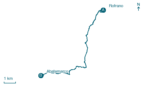
Tackle a demanding 12 km from Rofrano to Abatemarco via San Menale and Alfano, climbing 867 m along the way.
Before leaving Rofrano, locate Ruferano on the map. It is close to the starting point. On arrival in Abatemarco, consider a stop at Montana, close to the finish.
Look for these places on the stage map: San Menale, Alfano, and Laurito.
What to see on this stage
History and landmarks
Ruferano
< 100 m from the trail as the crow flies
Over the centuries, the historic center has risen and consolidated on the summit of a hill in the Piè degli Orti area and due to its conformation has not experienced expansion for a long time, except on the eastern side, being unable on the other sides.
Montana
100 m from the trail as the crow flies
The urban layout of Montano Antilia is typical of late medieval towns in Cilento.
Map · Rofrano → Abatemarco
Take your walk with you: download Appy
Cammino di San Nilo: Rofrano → Abatemarco. Explore maps, stages and elevation in the app, and plan your train or bus journey.

