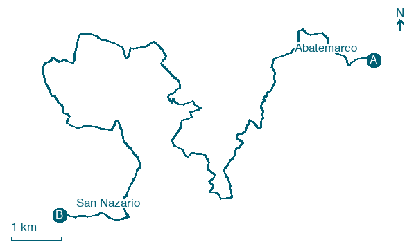
Abatemarco → San Nazario
Walking distance 22.9 km
Download Appy for the stage map
Stage information
- Ascent
- 1144 m
- Descent
- 1506 m
Difficulty: challenging
Walking the stage
Climb steadily over 23 km from Abatemarco to San Nazario, passing Localia Lamia and Limonti, gaining 1144 m of height.
Before leaving Abatemarco, locate Montana on the map. It is close to the starting point.
Look for these places on the stage map: Localia Lamia, Massicella, Cuccaro Vetere, and Castinatelli.
What to see on this stage
History and landmarks
Montana
400 m from the trail as the crow flies
The urban layout of Montano Antilia is typical of late medieval towns in Cilento.
Sant'Eufemia
Church · 1.4 km from the trail as the crow flies
Church, dedicated to Euphemia, in San Mauro La Bruca, Italy.
Map · Abatemarco → San Nazario
Take your walk with you: download Appy
Cammino di San Nilo: Abatemarco → San Nazario. Explore maps, stages and elevation in the app, and plan your train or bus journey.

