Poreta → Spoleto
Walking distance 15.5 km
Download Appy for the stage map
Stage information
- Ascent
- 703 m
- Descent
- 656 m
Difficulty: moderate
Walking the stage
Walk 16 km from Poreta to Spoleto with 703 m of climbing, passing Bazzano Inferiore and San Giacomo.
On arrival in Spoleto, consider a stop at Chiesa di San Ponziano, close to the finish.
Look for these places on the stage map: Bazzano Inferiore, Santa Maria, San Beroide, and La Fornace.
What to see on this stage
History and landmarks
Chiesa di San Ponziano
Church · < 100 m from the trail as the crow flies
Building with a rectangular shape and perimeter walls made of squared stone with regular courses and barrel vault in the main nave and barrel vaults in the side naves.
Crypt of San Ponziano
Church · < 100 m from the trail as the crow flies
building with a multilateral shape featuring perimeter walls made of squared stone with regular courses and a truss roof in the spans
Nature and landscape
Cipresso comune di Cimitero Comunale, Spoleto
Monumental tree · < 100 m from the trail as the crow flies
Italy’s monumental tree register identifies this specimen as Cupressus sempervirens L. It records a height of 16.5 m and a trunk circumference of 371 cm.
Roverella di Eggi, Spoleto
Monumental tree · < 100 m from the trail as the crow flies
Italy’s monumental tree register identifies this specimen as Quercus pubescens Willd. It records a height of 22.8 m and a trunk circumference of 434 cm.
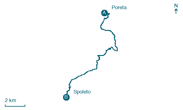
Map · Poreta → Spoleto
Take your walk with you: download Appy
Via di Francesco di Roma: Poreta → Spoleto. Explore maps, stages and elevation in the app, and plan your train or bus journey.

