Estellencs → Esporles
Walking distance 21.5 km
Download Appy for the stage map
Stage information
- Ascent
- 670 m
- Descent
- 1032 m
Difficulty: moderate
Walking the stage
Follow 22 km from Estellencs to Esporles through Banyalbufar and Son Coll, with 670 m of ascent.
Look for these places on the stage map: Banyalbufar and Son Coll.
What to see on this stage
History and landmarks
Prehistoric remains in ses Mosqueres / Potada des Cavall
Archaeological site · < 100 m from the trail as the crow flies
Archaeological site, in Banyalbufar, Spain, designated as bien de interés cultural.
Talayot de Ses Mosqueres (Racó de Banyalbufar)
< 100 m from the trail as the crow flies
Monument, in Banyalbufar, Spain, designated as bien de interés cultural.
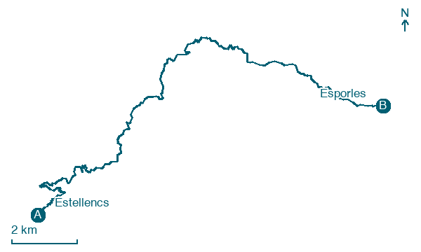
Map · Estellencs → Esporles
Take your walk with you: download Appy
GR221 Serra de Tramuntana (Mallorca): Estellencs → Esporles. Explore maps, stages and elevation in the app, and plan your train or bus journey.

