Murat → Le Lioran
Walking distance 14.1 km
Download Appy for the stage map
Stage information
- Ascent
- 982 m
- Descent
- 267 m
Difficulty: moderate
Walking the stage
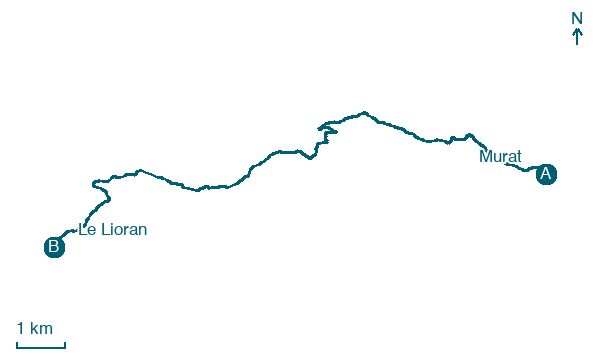
Climb 982 m over 14 km from Murat to Le Lioran, passing Fraisse Bas, Laveissière and Le Lioranval on the way.
Before leaving Murat, locate Rocher de Bonnevie on the map. It is close to the starting point.
Look for these places on the stage map: Fraisse Bas, Laveissière, Le Lioranval, and Font d'Alagnon.
What to see on this stage
History and landmarks
Rocher de Bonnevie
< 100 m from the trail as the crow flies
Volcanic neck rising over Murat, a town built at its foot. A statue of the Madonna and Child crowns the summit, at about 1,061 m, and overlooks the town.
Village fortifié du Roch
500 m from the trail as the crow flies
Historic village, in Chastel-sur-Murat, France, designated as classified historical monument.
Map · Murat → Le Lioran
Take your walk with you: download Appy
GR400 - Tour du Cantal: Murat → Le Lioran. Explore maps, stages and elevation in the app, and plan your train or bus journey.

