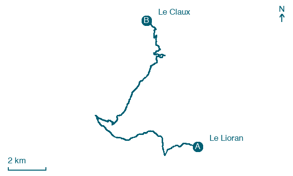
Le Lioran → Le Claux
Walking distance 17.6 km
Download Appy for the stage map
Stage information
- Ascent
- 286 m
- Descent
- 932 m
Difficulty: moderate
Walking the stage
Follow 18 km from Le Lioran to Le Claux through Font d'Alagnon and La Maurinie, with only 286 m of climbing.
Look for these places on the stage map: Font d'Alagnon, La Maurinie, and La Gandilhon.
What to see on this stage
Nature and landscape
Puy Griou
1.9 km from the trail as the crow flies
Summit of 1,690 m in the Monts du Cantal, on the ridge between the Cère and Jordanne valleys, above Saint-Jacques-des-Blats and Mandailles.
Puy Mary
< 100 m from the trail as the crow flies
Map · Le Lioran → Le Claux
Take your walk with you: download Appy
GR400 - Tour du Cantal: Le Lioran → Le Claux. Explore maps, stages and elevation in the app, and plan your train or bus journey.

