A Coruña → Carral
Walking distance 20 km
Download Appy for the stage map
Stage information
- Ascent
- Estimated 800 m
- Descent
- Estimated 700 m
Difficulty: easy
Walking the stage
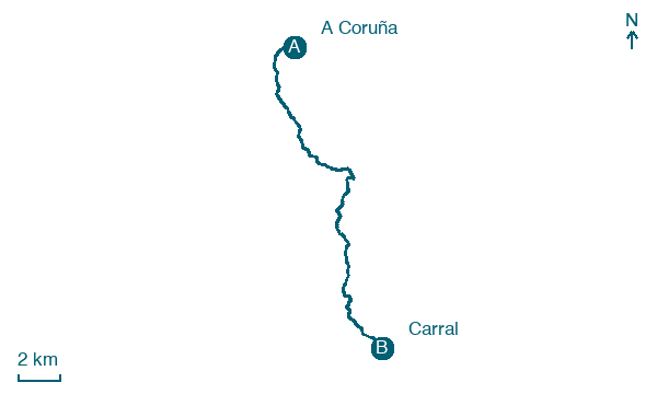
Start in A Coruña and walk 20 km to Carral, passing Eirís de Arriba, Penarredonda and O Seixo.
Before leaving A Coruña, locate Iglesia de Santiago on the map. It is close to the starting point.
Look for these places on the stage map: Eirís de Arriba, O Seixo, Ponte, and Altamira.
What to see on this stage
History and landmarks
Houses of Paredes
< 100 m from the trail as the crow flies
Monument in Neoclassicism style, in A Coruña, Spain, designated as bien de interés cultural.
Iglesia de Santiago
< 100 m from the trail as the crow flies
The oldest church in A Coruña, begun in the second half of the 12th century in Romanesque style and reworked after several fires. The west portal has a pointed arch full of carved angels, Christ in Majesty at the keystone and Saint James on horseback.
Nature and landscape
A Madosa
Summit · 100 m from the trail as the crow flies
Monte Mero
Summit · 200 m from the trail as the crow flies
Map · A Coruña → Carral
Take your walk with you: download Appy
Camino Inglés (A Coruña): A Coruña → Carral. Explore maps, stages and elevation in the app, and plan your train or bus journey.

