Carral → Mesía
Walking distance 12.6 km
Download Appy for the stage map
Stage information
- Ascent
- 418 m
- Descent
- 153 m
Difficulty: easy
Walking the stage
Climb 418 m over 13 km from Carral to Mesía, passing A Bailía, Padín and O Peito on the way.
Look for these places on the stage map: A Bailía, Padín, O Peito, and San Bartolomeu.
What to see on this stage
History and landmarks
Torre de Balbén
Tower · 2 km from the trail as the crow flies
Tower of Balbén. Tower, in Q20548895, Spain, designated as bien de interés cultural.
Mámoas do Montes de San Bartolamé
Archaeological site · < 100 m from the trail as the crow flies
Nature and landscape
Monte da Piolla
Summit · 700 m from the trail as the crow flies
Monte do Castro
Summit · 700 m from the trail as the crow flies
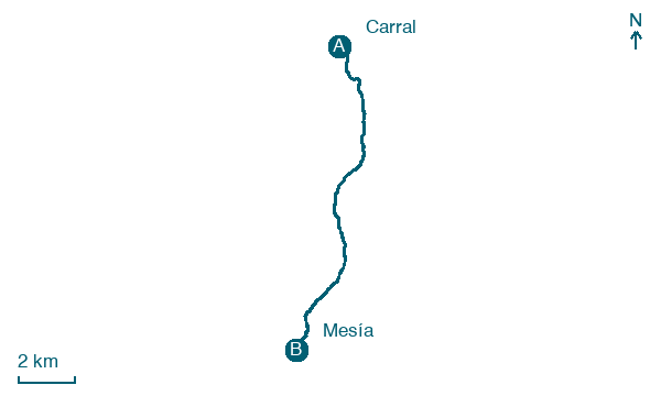
Map · Carral → Mesía
Take your walk with you: download Appy
Camino Inglés (A Coruña): Carral → Mesía. Explore maps, stages and elevation in the app, and plan your train or bus journey.

