Refugi de Certascan → Refugi de Pinet
Walking distance 19.3 km
Download Appy for the stage map
Stage information
- Ascent
- 462 m
- Descent
- 963 m
Difficulty: moderate
Walking the stage
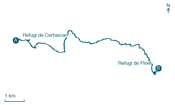
Follow the trail 19 km from Refugi de Certascan via L'Artigue to Refugi de Pinet, with 462 m of climbing.
Look for these places on the stage map: L'Artigue.
The organiser’s itinerary from Certascan to Pinet visits the Romedo lakes and the lake of Montestaure. Compare your intended track with the organiser’s stage before setting off. Its distance and ascent differ from the track shown here.
Read more at La Porta del Cel.
Map · Refugi de Certascan → Refugi de Pinet
Take your walk with you: download Appy
Porta del Cel: Refugi de Certascan → Refugi de Pinet. Explore maps, stages and elevation in the app, and plan your train or bus journey.

