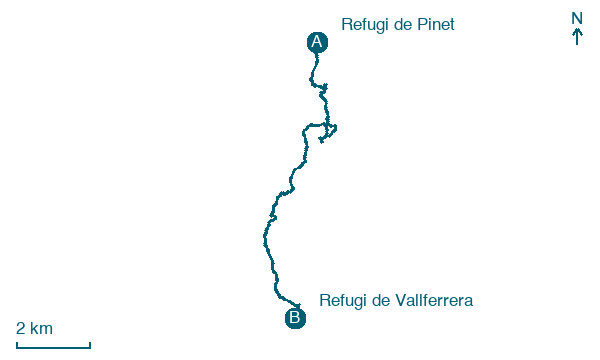
Refugi de Pinet → Refugi de Vallferrera
Walking distance 18.7 km
Download Appy for the stage map
Stage information
- Ascent
- 713 m
- Descent
- 394 m
Difficulty: moderate
Walking the stage
Head from Refugi de Pinet through Marc and Pla de l'Izard to Refugi de Vallferrera, 19 km with 713 m of ascent.
Look for these places on the stage map: Marc and Pla de l'Izard.
Between Pinet and Vallferrera, the organiser describes a high mountain route up Pica d’Estats followed by a long descent. Its distance and ascent differ from this track. Check which route you plan to follow and the conditions at altitude.
Read more at La Porta del Cel.
Map · Refugi de Pinet → Refugi de Vallferrera
Take your walk with you: download Appy
Porta del Cel: Refugi de Pinet → Refugi de Vallferrera. Explore maps, stages and elevation in the app, and plan your train or bus journey.

