Arenas → Su Mannau
Walking distance 13.3 km
Download Appy for the stage map
Stage information
- Ascent
- 452 m
- Descent
- 837 m
Difficulty: moderate
Walking the stage
An easy, mostly downhill walk of about 13 km from Arenas past the spring of Pubusinu and the caves of Su Mannau. It also passes the old Gutturu Pala mine and the mine museum of Su Zurfuru.
Look for these places on the stage map: Frùmini Majori/Fluminimaggiore.
What to see on this stage
Nature and landscape
Leccio di Corona Arrubia - Sa Grutta De Mandia, Fluminimaggiore
Monumental tree · 1.5 km from the trail as the crow flies
Italy’s monumental tree register identifies this specimen as Quercus ilex L. It records a height of 10 m and a trunk circumference of 300 cm.
Sughera di Antas, Fluminimaggiore
Monumental tree · 1.8 km from the trail as the crow flies
Italy’s monumental tree register identifies this specimen as Quercus suber L. It records a height of 10 m and a trunk circumference of 470 cm.
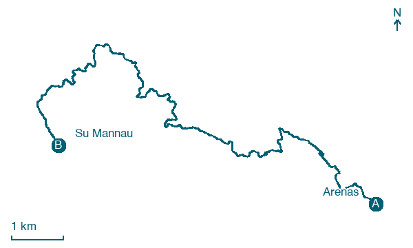
Map · Arenas → Su Mannau
Take your walk with you: download Appy
Cammino Minerario di Santa Barbara: Arenas → Su Mannau. Explore maps, stages and elevation in the app, and plan your train or bus journey.

