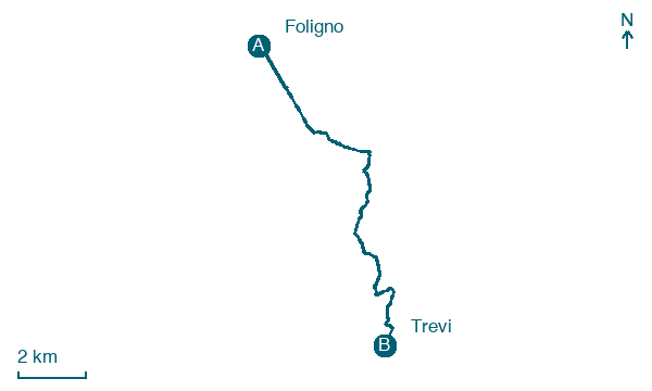
Foligno → Trevi
Walking distance 12.4 km
Download Appy for the stage map
Stage information
- Ascent
- 378 m
- Descent
- 195 m
Difficulty: moderate
Walking the stage
Cover 12 km from Foligno to Trevi, climbing 378 m, passing Uppello and Santo Stefano dei Piccioni.
Before leaving Foligno, locate Museo di Palazzo Trinci on the map. It is close to the starting point.
Look for these places on the stage map: Uppello, Colle di Scandolaro, Roviglieto, and San Pietro a Pettine.
What to see on this stage
History and landmarks
Museo di Palazzo Trinci
Museum · < 100 m from the trail as the crow flies
Foligno Cathedral
Cathedral · < 100 m from the trail as the crow flies
Nature and landscape
Roverella di Santa Maria in Valle, Trevi
Monumental tree · < 100 m from the trail as the crow flies
Italy’s monumental tree register identifies this specimen as Quercus pubescens Willd. It records a height of 20.2 m and a trunk circumference of 370 cm.
Leccio di Via Gentile da Foligno, Foligno
Monumental tree · 400 m from the trail as the crow flies
Italy’s monumental tree register identifies this specimen as Quercus ilex L. It records a height of 15.8 m and a trunk circumference of 335 cm.
Map · Foligno → Trevi
Take your walk with you: download Appy
Via di Francesco di Roma: Foligno → Trevi. Explore maps, stages and elevation in the app, and plan your train or bus journey.

