Lourdes → Saint-Pé-de-Bigorre
Walking distance 11.7 km
Download Appy for the stage map
Stage information
- Ascent
- 351 m
- Descent
- 408 m
Difficulty: moderate
Walking the stage
From the famous Marian shrine of Lourdes, begin the journey south through the foothills of the Pyrenees, following the Gave de Pau river valley to Saint-Pé-de-Bigorre.
Before leaving Lourdes, locate Sanctuary of Our Lady of Lourdes on the map. It is close to the starting point. On arrival in Saint-Pé-de-Bigorre, consider a stop at Abbaye de Saint-Pé-de-Bigorre, close to the finish.
Look for these places on the stage map: Hayet, Peyrouse, and Rieulhès.
What to see on this stage
History and landmarks
Sanctuary of Our Lady of Lourdes
< 100 m from the trail as the crow flies
Abbaye de Saint-Pé-de-Bigorre
Abbey · 100 m from the trail as the crow flies
Nature and landscape
Caster Bern
Summit · 400 m from the trail as the crow flies
Turoum Esplat
Summit · 600 m from the trail as the crow flies
Map · Lourdes → Saint-Pé-de-Bigorre
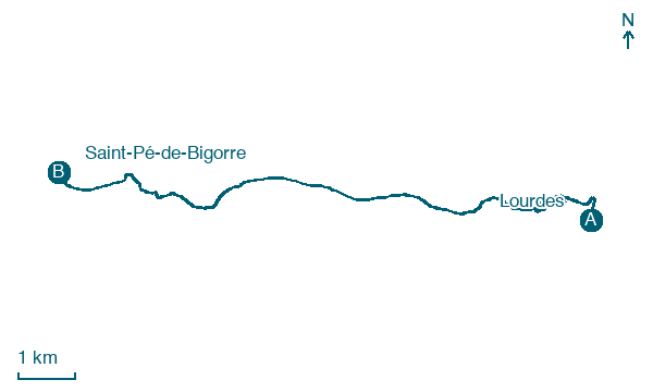
Take your walk with you: download Appy
Camino de Lourdes: Lourdes → Saint-Pé-de-Bigorre. Explore maps, stages and elevation in the app, and plan your train or bus journey.

