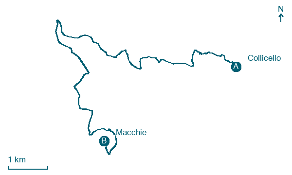
Collicello → Macchie
Walking distance 12.1 km
Download Appy for the stage map
Stage information
- Ascent
- 424 m
- Descent
- 359 m
Difficulty: moderate
Walking the stage
Walk 12 km from Collicello to Macchie, with 424 m of climbing along the way, passing through Frattuccia and Santa Restituta.
Before leaving Collicello, locate Castello di Collicello on the map. It is close to the starting point.
Look for these places on the stage map: Frattuccia and Santa Restituta.
What to see on this stage
History and landmarks
Castello di Collicello
Castle · 100 m from the trail as the crow flies
One of three fortified villages Amelia founded in the thirteenth and fourteenth centuries, with Frattuccia and Sambucetole, to guard its lands. For over a century and a half it stayed a centre of raids, mostly by Todi.
Monte Pianicel Grande
1 km from the trail as the crow flies
Summit of the Monti Amerini in Umbria, marked by a wooden cross. Hiking loops from Melezzole pass over it on the way down to Santa Restituta.
Nature and landscape
Grotta Bella
1.2 km from the trail as the crow flies
Cave. Grotta Bella is a cave and archaeological site located near Avigliano Umbro in Italy.
Map · Collicello → Macchie
Take your walk with you: download Appy
Cammino di Germanico: Collicello → Macchie. Explore maps, stages and elevation in the app, and plan your train or bus journey.

