Ourense → Cea
Walking distance 22.5 km
Download Appy for the stage map
Stage information
- Ascent
- 558 m
- Descent
- 186 m
Difficulty: moderate (estimated)
Walking the stage
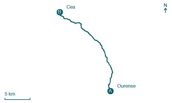
Leave Ourense and cover 22 km to Cea, passing Cudeiro, Sartédigos and Almuzada with 558 m of climbing.
Before leaving Ourense, locate Pazo de los Oca-Valladares on the map. It is close to the starting point.
Look for these places on the stage map: Cudeiro, Almuzada, Faramontaos, and A Casanova.
What to see on this stage
History and landmarks
Puente Mayor
Bridge · < 100 m from the trail as the crow flies
A medieval bridge on Roman piers, rebuilt in 1230 and again in 1679 after its great arch fell in 1499. Seven arches carry it over the Miño, the main one spanning 43 metres, and it was once reckoned the biggest bridge in Spain.
Pazo de los Oca-Valladares
100 m from the trail as the crow flies
Monument, in Ourense, Spain, designated as bien de interés cultural.
Nature and landscape
Unión Deportiva Ourense
700 m from the trail as the crow flies
Gorge. Unión Deportiva Ourense is a Spanish football club based in Ourense, in the autonomous community of Galicia.
Velle Reservoir
Lake · 900 m from the trail as the crow flies
Map · Ourense → Cea
Take your walk with you: download Appy
Camino Sanabres: Ourense → Cea. Explore maps, stages and elevation in the app, and plan your train or bus journey.

