Venarotta → Comunanza
Walking distance 13.3 km
Download Appy for the stage map
Stage information
- Ascent
- 598 m
- Descent
- 355 m
Difficulty: moderate
Walking the stage
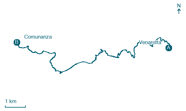
Stage 2 (Venarotta → Comunanza) covers 13.3 km on foot.
Before leaving Venarotta, locate Chiesa di San Francesco on the map. It is close to the starting point.
Look for these places on the stage map: Case Nuove di Capodipiano, Olibra Incinante, Pedara, and Furcola.
What to see on this stage
History and landmarks
Chiesa di San Francesco
Church · < 100 m from the trail as the crow flies
Church of San Francesco. Church, in Venarotta, Italy, designated as Italian national heritage.
Settlement, traces of settlement
Archaeological site · < 100 m from the trail as the crow flies
During the construction works for the SS. 78 road axis in the Colle Martino area, an archaeological layer was exposed at about 0.50 m from the ground level, consisting of two contiguous pits of about 2 m in diameter.
Nature and landscape
Roverella di Capodipiano, Venarotta
Monumental tree · 100 m from the trail as the crow flies
Italy’s monumental tree register identifies this specimen as Quercus pubescens Willd. It records a height of 25 m and a trunk circumference of 470 cm.
Roverella di Casa dell'Orso, Roccafluvione
Monumental tree · 700 m from the trail as the crow flies
Italy’s monumental tree register identifies this specimen as Quercus pubescens Willd. It records a height of 23.2 m and a trunk circumference of 490 cm.
Map · Venarotta → Comunanza
Take your walk with you: download Appy
Grande Anello dei Borghi Ascolani: Venarotta → Comunanza. Explore maps, stages and elevation in the app, and plan your train or bus journey.

