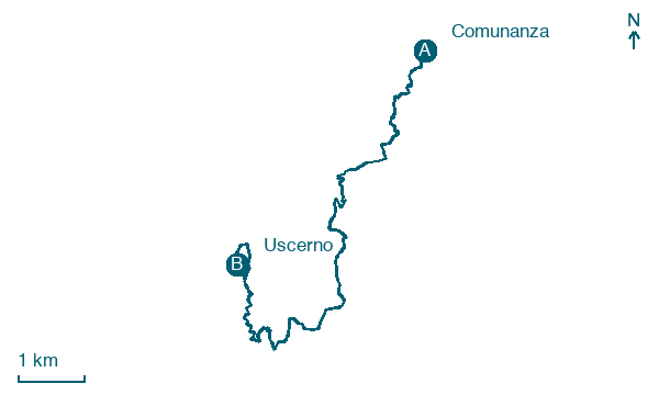
Comunanza → Uscerno
Walking distance 10.9 km
Download Appy for the stage map
Stage information
- Ascent
- 497 m
- Descent
- 355 m
Difficulty: moderate
Walking the stage
Stage 3 (Comunanza → Uscerno) covers 10.9 km on foot.
On arrival in Uscerno, consider a stop at Chiesa dei Santi Pietro e Paolo, close to the finish.
Look for these places on the stage map: Cossinino da piedi, Meschia, and Gaico.
What to see on this stage
History and landmarks
Chiesa dei Santi Pietro e Paolo
Church · < 100 m from the trail as the crow flies
Church of Saints Peter and Paul. Church, in Montegallo, Italy, designated as Italian national heritage.
Casa parrocchiale
1 km from the trail as the crow flies
regular in plan and in the arrangement of openings; irregular in elevation; constructional and material discontinuities
Map · Comunanza → Uscerno
Take your walk with you: download Appy
Grande Anello dei Borghi Ascolani: Comunanza → Uscerno. Explore maps, stages and elevation in the app, and plan your train or bus journey.

