Sobrado dos Monxes → Arzúa
Walking distance 21.9 km
Download Appy for the stage map
Stage information
- Ascent
- 223 m
- Descent
- 339 m
Difficulty: moderate (estimated)
Walking the stage
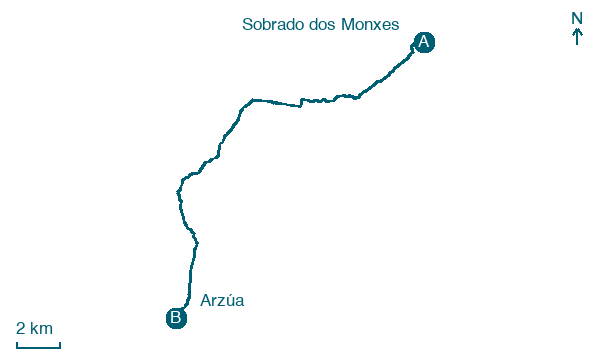
Walk 22 km from Sobrado dos Monxes to Arzúa through Vilarchao and Madelos, with 223 m of ascent.
Before leaving Sobrado dos Monxes, locate Sobrado Abbey on the map. It is close to the starting point.
Look for these places on the stage map: Vilarchao, O Coto Salgueiro, O Pazo, and Os Rascados.
What to see on this stage
History and landmarks
Sobrado Abbey
200 m from the trail as the crow flies
12th-century cistercian architecture monument. Founded by Hermenegildo Alóitez.
Puente de Ribadiso
Bridge · 2 km from the trail as the crow flies
Bridge, in Arzúa, Spain, designated as part of UNESCO World Heritage Site.
Nature and landscape
Coto da Igrexa
Summit · 200 m from the trail as the crow flies
O Pinar
Summit · 200 m from the trail as the crow flies
Map · Sobrado dos Monxes → Arzúa
Take your walk with you: download Appy
Camino del Norte: Sobrado dos Monxes → Arzúa. Explore maps, stages and elevation in the app, and plan your train or bus journey.

