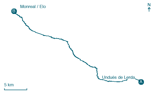
Undués de Lerda → Monreal / Elo
Walking distance 37.6 km
Download Appy for the stage map
Stage information
- Ascent
- 494 m
- Descent
- 564 m
Difficulty: moderate
Walking the stage
Cover 38 km from Undués de Lerda to Monreal / Elo, passing Sangüesa / Zangoza, Rocaforte and Izco.
Look for these places on the stage map: Sangüesa / Zangoza, Nardués-Aldunate, Abínzano, and Salinas de Ibargoiti / Getze Ibargoiti.
What to see on this stage
History and landmarks
Palacio Real de Sangüesa
Palace · < 100 m from the trail as the crow flies
13th-century palace, in Sangüesa/Zangoza, Spain, designated as part of UNESCO World Heritage Site.
Puente de Vadoluengo
Bridge · 1,000 m from the trail as the crow flies
12th-century bridge, in Sangüesa/Zangoza, Spain.
Nature and landscape
El Castillo
Summit · 100 m from the trail as the crow flies
Txosne
Summit · 200 m from the trail as the crow flies
Map · Undués de Lerda → Monreal / Elo
Take your walk with you: download Appy
Camino Aragonés: Undués de Lerda → Monreal / Elo. Explore maps, stages and elevation in the app, and plan your train or bus journey.

