Monreal / Elo → Obanos
Walking distance 28.2 km
Download Appy for the stage map
Stage information
- Ascent
- 402 m
- Descent
- 530 m
Difficulty: moderate
Walking the stage
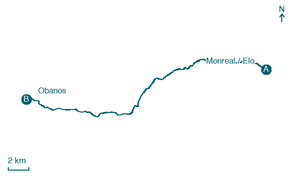
Finish in Obanos after 28 km from Monreal / Elo, passing Yarnoz, Otano and Tiebas / Tebas, with 402 m of climbing.
Before leaving Monreal / Elo, locate Castillo de Elo on the map. It is close to the starting point.
Look for these places on the stage map: Yarnoz, Tiebas / Tebas, Olkotz / Olcoz, and Muruzábal.
What to see on this stage
History and landmarks
Castillo de Tiebas
Castle · < 100 m from the trail as the crow flies
Castle, in Tiebas-Muruarte de Reta, Spain, designated as bien de interés cultural.
La Higa
1.5 km from the trail as the crow flies
Natural landmark. Higa (spanish: La Higa) is a mountain in Monreal, Navarre, Spain, to the southeast of Pamplona.
Nature and landscape
Sagrado Corazón
Summit · 100 m from the trail as the crow flies
Castillo de Elo
Summit · 100 m from the trail as the crow flies
Map · Monreal / Elo → Obanos
Take your walk with you: download Appy
Camino Aragonés: Monreal / Elo → Obanos. Explore maps, stages and elevation in the app, and plan your train or bus journey.

