Capo Sandalo → Portoscuso
Walking distance 17.9 km
Download Appy for the stage map
Stage information
- Ascent
- 399 m
- Descent
- 471 m
Difficulty: moderate
Walking the stage
This walk of about 19 km circles part of the island of San Pietro from Carloforte, past Canalfondo Beach and Tacca Rossa Beach, the closed Sea Museum of the Galanzieri family and the Tonnara La Punta tuna works. It ends with a ferry crossing back to the mainland at Portoscuso.
On arrival in Portoscuso, consider a stop at Fortress, close to the finish.
Look for these places on the stage map: Girin and Giunco.
What to see on this stage
History and landmarks
Fortress
Castle · 300 m from the trail as the crow flies
rectangular construction with a tripartite plan and a convex main facade. Two above-ground levels at different heights, with a taller central body.
San Vittorio tower
Tower · 500 m from the trail as the crow flies
Tower, in Carloforte, Italy, designated as Italian national heritage.
Nature and landscape
Spiaggia dello Spalmatore
Beach · < 100 m from the trail as the crow flies
Spiaggia Giunco
Beach · 400 m from the trail as the crow flies
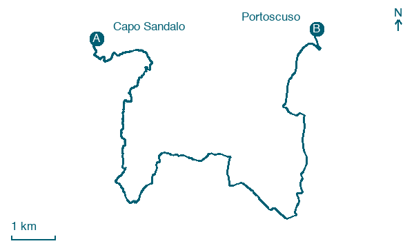
Map · Capo Sandalo → Portoscuso
Take your walk with you: download Appy
Cammino Minerario di Santa Barbara: Capo Sandalo → Portoscuso. Explore maps, stages and elevation in the app, and plan your train or bus journey.

